So…we might have jinxed ourselves with that last post.
Rain, rain go away

Typically, the Atacama desert receives .08 inches of rain in March.
By the time we arrived, San Pedro de Atacama had already had two solid weeks of rain and it showed no signs of slowing down for at least two days. What?!
Floods swamp Chile's Atacama region - The Guardian
We arrived to a torrential downpour on night one, then spent the next day ducking out of the rain and trying to plan activities with our friend Billy, who joined us toward the tail end of his own South American adventure. We’d heard it rains more in the evening, so we attempted to book a tour of several high altitude lakes first thing in the morning on the third day.
The next day we sped out over washed-out roads for almost two hours to the turnout for the lagunas altiplanicas, only to discover that it had turned into a river and was impassable. The tour guide tried really, really hard to figure out some alternative attractions to see, including a lake closer to town (also closed), the salt flats (also closed), and finally, (sorpresa!) a hotel bar where we looked at photos of someone discovering a perfect spherical rock while scuba diving in a lake on top of one of the nearby mountains. Not exactly the lake tour we had in mind.
By the time the tour ended and we got back to town, all cell reception and internet had been knocked out in northern Chile, and the government was declaring a state of emergency in a number of cities. We were dismayed by our first failed trip out into the desert, but it only made it that much more amazing once the weather cleared up and we could witness the snow and a touch of green left behind by the rain.
High altitude geysers
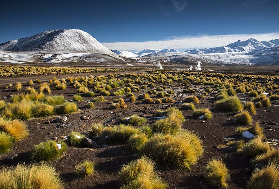
The next morning, we hauled ourselves out of bed at 4:00 AM and caught a bus with our friends Billy and Adrian out to the Geysers del Tatio. These are among the highest geysers on the planet, which (contrary to what we originally thought) doesn’t mean they shoot up impressively high but rather are located at extreme elevation. Up, up, up the bus climbed in the dark, to a final height of 4,320 m (14,173 ft, roughly equal to Mt. Rainier) above sea level. Although the abrupt altitude change definitely affected us, our whole tour group managed to make it there without having to turn back.
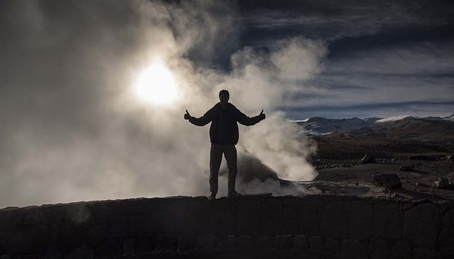
After walking through the steamy, bubbly geysers for a while, we had a quick breakfast of hardboiled eggs and hot chocolate that were both heated up by—you guessed it—the geysers. Once we’d finished, we all made our way into a geothermal pool, which became more of a polar bear plunge with the freezing temperatures outside. Alas, Nick is the only one that has photographic evidence of this superhuman feat.

On the way back down to San Pedro, we visited a tiny village where we tasted some llama kebabs and waited for our driver (who is apparently the most badass tour bus driver in all of Chile) to go rescue another tour group that was stuck trying to reach the geysers.
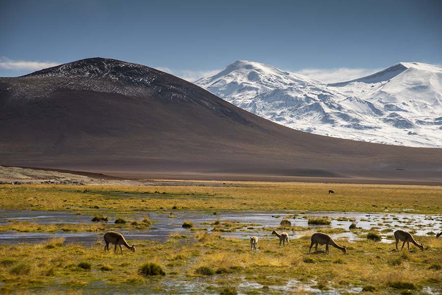
After our hero returned, we drove on through a flamingo reserve and a desert oasis, which was home to tons of birds and vicuñas. Vicuñas are similar to alpacas or guanacos but smaller and with an even finer, softer coat that used to be illegal to wear unless you were Inca royalty. Unfortunately, we didn't get to pet one.
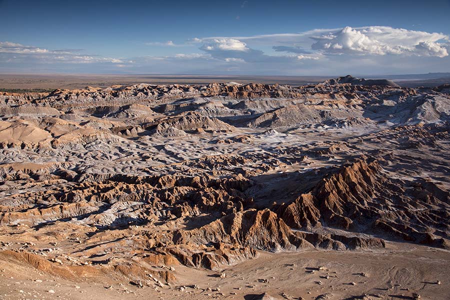
The Valley of the Moon
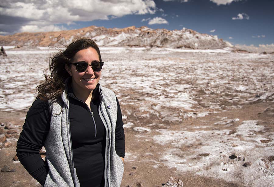
After a short rest back at the hostel, we were kidnapped due to a clerical error and taken on a tour of the Valle de la Lune (Valley of the Moon). This actually played out in our favor, as we got to start our tour about an hour before the droves of other tour groups arrived, and we more or less had the valley to ourselves.
The valley lies below a small mountain range called Las Montañas del Sal (Salt Mountains), and you can pretty easily see why they got this name:
There were a ton of interesting geological features, including dunes and huge formations caused by a wrinkle in tectonic plates as the Nazca plate subducts under the South American plate. The entire valley is rich with minerals, and most of it is actually made from one enormous crystalline structure that has broken down over time and been covered with sedimentary rock. Where it’s exposed, it’s super shiny and pretty.

It was also extremely windy, as evidenced by my hair in most of our pictures from the day.
Desert landscapes
Once we’d seen everything there is to see in the Valley of the Moon, we headed up to Coyote Rock for a fantastic lookout over the salty ridges below, as well as some more gale-force winds.
Hiking with Bill the dog

On our last day, we decided to take it easy and do some hiking on our own around San Pedro. We picked up a friend along the way, a dog we decided “looks like he could be a Bill," and climbed a couple of hills around the Valle del Muerte (Death Valley) to get a better view. He stuck with us most of the way before realizing he was a faster downhill hiker than us and moving on.
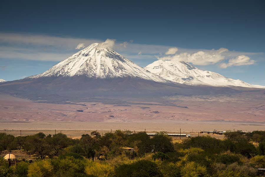
The day was amazingly clear, as we’re told is the norm, so we could see all the way to the volcanoes that mark the edge of the Andes from our perch.

We thought we were being pretty adventuresome, but then we discovered a pop-up café on our way back where you could basically order frappucinos. Guess we didn’t make it too far out of town after all :)

Up next
Creatives, colors, and ceviche in the port city of Valparaiso, Chile!